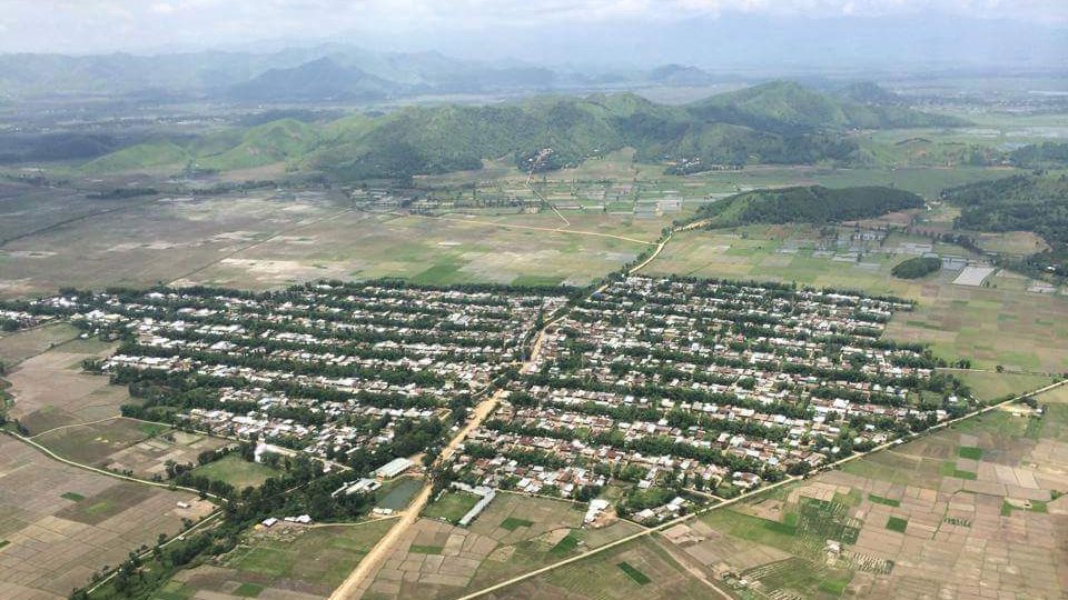
Kakching Khunou is a small, sleepy agrarian town in the Kakching District of Manipur, nestled within the fertile narrow plains in the southern periphery of the valley. Surrounded by hillocks and agricultural land, it has a land area of about 2 sq. km. Imphal, the capital city of Manipur is at a distance of 65 km from the town. A meandering road bifurcated from the Imphal-Sugnu road touches the town from the eastern side and many other inter-village roads connect it with other villages in the neighbourhood. Tarang Turel, a rivulet with a perennial source of water- originated from the eastern hills, flows through the town bisecting it in two symmetrical halves. The rivulet flows towards the western lowlands and joins the Imphal River through Maramba Maril which drains water from the Pumlen Lake. Paddy cultivation, vegetable farming, horticulture, pisciculture (fish-farming), carpentry, handloom, etc. are some of the main occupations of the people. With an estimated population of about 11,379 (2011 census), the town is now elevated to the status of a municipality.
History:
As the name clearly indicates, the town was newly settled as a village around 250 years ago by a community of Loi people migrated from Kakching, another town inhabited by Loi people in the northeast at about 20 km. It is believed that these professional people under the leadership of Khamlangba first came from the west and settled down at Uripok, Imphal though their pre-historic records could not be traced.
These laborious people in search of iron-ore moved from Uripok towards the south and settled for some time near Kshetri Leikai of present Thoubal, during the reign of Charailongba. Shortly thereafter, they migrated to Kakching Khuman near Pallel, and during the reign of Garib Niwas Kakching was governed by Budhiraj (“The Meitheis, Page 9, T.C. Hudson). In the year 1790, during the reign of Bheigyachandra, they shifted to the present Kakching site while some sections moved further south and first settled at ‘Karbung’ a place about 2 km from the present Kakching Khunou in the south. After some time they shifted to the present site. In 1804 (1726 Saka) during the reign of Chourajit one Leimapokpam Chandra was transported as Loi at Kakching Khunou which is evident of having the village existed (Cheitharol Kumbaba, Page 184, 1989 ed).
The Historical evidence of these people can easily be traced from many authentic books and records. Special mention in this connection can be made of that of Captain R. Boileau Pemberton’s ‘Report on the Eastern Frontier of British India, 1835′ in which he described at page 30 “..Kokshing lungsaee, Kokshing Khunao, Kokshing Khoolen and Langathel are the principal villages at which the iron works are carried on, under the direction of Chieftains called Budhiraj Rajah, who claims for his ancestors the merit of having first discovered the existence of iron-ore in the valley and of rendering it subserve into the use of man”.
And these professional people were also governed through the leadership of one Khullakpa as Hudson clearly mentioned in his book “The Meitheis” (page 72). In Gazetteer of Manipur Capt. E.W. Dun clearly stated the settlement of Kakching Khunou village. Moreover, all the Kakching Villages in Manipur worshipped Khamlangba and Sekmai Ningthou as their Umanglai (Forest Deity), which are the symbols of iron.
Genealogy:
The earliest settlers of Kakching Khunou was composed of 15 Yumnaks (surnames) settled in groups under one elder known as Piba and altogether intertwined and also mingled with one another as up to 1886. The 15 Yumnaks are: 1) Khumukcham 2) Mayanglambam 3) Thingnam 4) Sarangthem 5) Kshetrimayum 6) Angom 7) Khaidem 8) Laishram 9) Leimapokpam 10)Keisham 11) Irom 12) Amom 13)Sanasam 14) Khongbantabam 15) Ngangom.
Moreover, the following Brahman clans who settled down permanently as Sevayets of the Deities, worshiped by these people when they were converted into Hinduism, are also found in Kakching Khunou. The clans are – 1) Kakchingtabam 2) Hidangmayum 3) Aribam 4) Gotimayum 5) Gurumayum. In later years many individuals of different clans came to Kakching Khunou and settled down permanently. They are- Achom, Adhikarimayum, Athokpam, Chingtham, Elangbam, Hamom, Heikrujam, Heisnam, Hidam, Huidrom, Huirem, Irengbam, Irungbam, Khangenbam, Khumanthem, Khundrakpam, Konjengbam, Langpoklakpam, Lourembam, Lukram, Mairenbam, Moirangthem, Nahakpam, Narekpam, Ngasepam, Ningthoujam, Nongmaithem, Okram, Phairembam, Potshangbam, Pukhrambam, Puyam, Raj Kumar (R.K.), Sagolsem, Salam, Samurailatpam, Sapam, Shamjetshabam, Sinam, Soibam, Sorokhaibam, Takhellambam, Thokchom, Thongam, Thounaojam, Ushekpam, Yenkhom, Yumnam etc.
Religion:
The pre-historic religion of the Kakchings prior to their arrival at Uripok cannot be traced, but it can definitely be counted that they adopted the Meitei religion before their conversion into Hinduism. In describing the Kakching Lois, Capt. E.W.Dun in his book, Gazetteer of Manipur (page 129) had quoted the writings of Sir James Johnstone in connection with their religion, “..they were Lois but now called themselves Hindoos, having some time since 1867 been adopted into the Hindoo community by the Rajah, and they give themselves all the airs of Hindoos!”
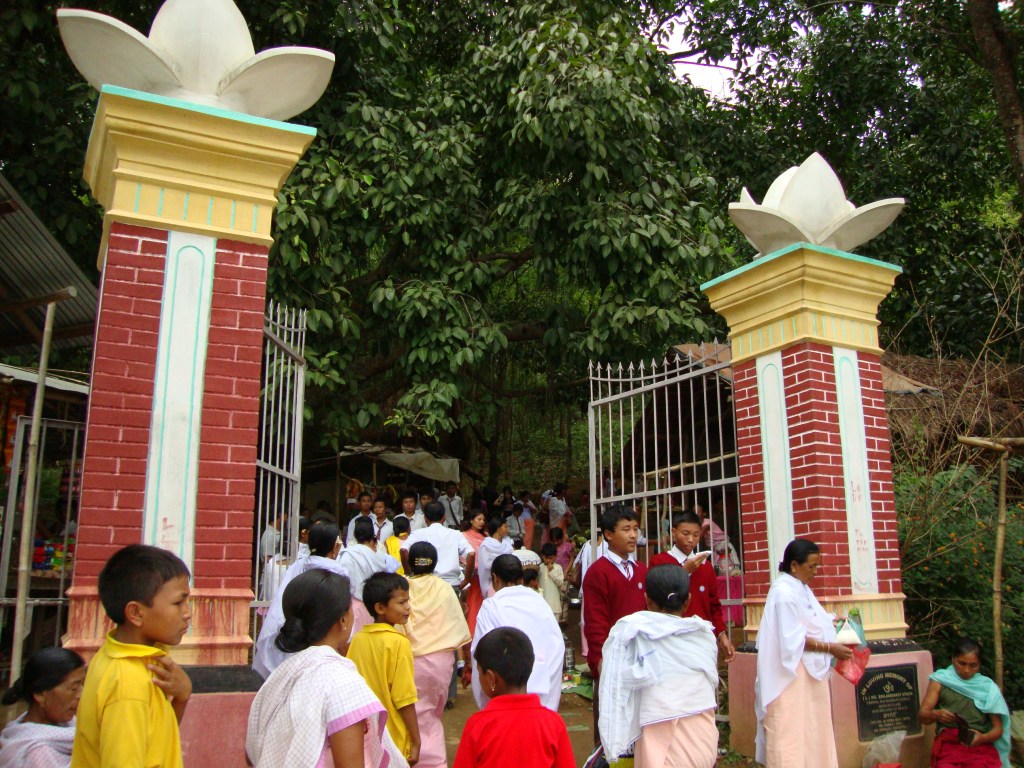

The majority of the population follows Hinduism. Some follow the old Meitei religion of Sanamahism and a minuscule section of the population has embraced Christianity. The famous Lord Shiv Temple also known as Mondum Mahadeva at Tokpaching is about 5 km in the northwest of Kakching Khunou.
Governance/Custom:

The Governance of Kakching Khunou was carried out under the Chieftain called Ningthou, Senapati, Khullakpa, Luplakpa, Naharakpa, Lanchingba, Nambor etc. One building known as ‘Loishang’ was constructed at the centre of the village where the village administration is carried out. In this building, the village Drum known as Pungjao is kept. And when the drum was beaten all the villagers were assembled there. Intermarriages with castes Meiteis were forbidden. The people were not allowed to cast their Panchayat vote and were mostly engaged as cheithabas in the pre-independent Manipur because of their Loi lineage. Chandan Tax (Chandon Senkhai) were also imposed to them by the Maharaja of Manipur.
Now, elevated as a municipality, a council of 9 members, elected every 5-years from each ward, looks after the welfare of the people. It normally looks after the basic amenities such as water, power, solid waste management etc. It is also authorized to build roads within the municipality limits.
Population & Literacy:
As per the Population Census 2011 records, the total population of Kakching Khunou is 11,379 out of which 5,935 are males and 5,444 are females. Thus, the Average Sex Ratio is 917. There are a total of 2,278 families residing in Kakching Khunou as per the census records. The population of the town has increased by 22.1% in the last decade. In 2001 census total population here were 9318.
Population : 11,379 | Literacy: 75.87% | Sex Ratio: 917
According to the 2011 India census, Kakching Khunou has an average literacy rate of 75.87% (Male literacy: 85.2%, and female literacy: 65.6%), above the national average of 74.04% but lower than the average literacy rate 76.94% of Manipur. The literacy rate of Kakching Khunou in 2001 was 67.6%. Overall literacy rate has increased by 8%. Male literacy has gone up by 5% and female literacy rate has gone up by 11%.
Distribution of population:
Kakching Khunou is further divided into 9 wards. Ward Nos. 1 and 5 have the highest and lowest population respectively.
| Sl | Ward | Population | Literacy |
|---|---|---|---|
| 1 | Ward No – 1 | 2,329 | 69.7% |
| 2 | Ward No – 2 | 1,129 | 64.7% |
| 3 | Ward No – 3 | 995 | 65.7% |
| 4 | Ward No – 4 | 1,044 | 70.3% |
| 5 | Ward No – 5 | 914 | 73.7% |
| 6 | Ward No – 6 | 988 | 75.9% |
| 7 | Ward No – 7 | 1,069 | 65.7% |
| 8 | Ward No – 8 | 1,023 | 66.8% |
| 9 | Ward No – 9 | 1,888 | 55.3% |
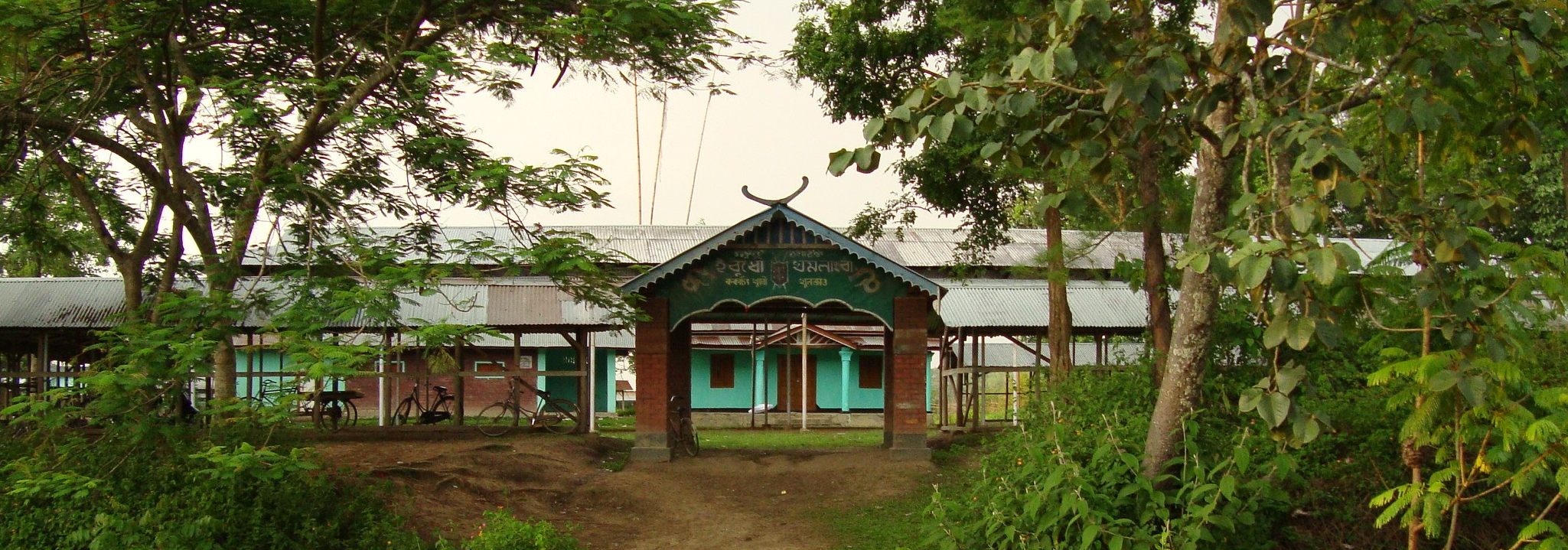
Educational Institutions at Kakching Khunou:
- Government:
- Kakching Khunou College
- Jawahar Navodaya Vidyalaya, Sandumba Achouba
- Kakching Khunou High School
- Thongam Mondum Upper Primary School
- Kakching Khunou Tampakyum P/S (Kakching Khunou Tampakyum L. P.)
- Kakching Khunou P/S (Kakching Khunou Girls’ L. P.)
- Kakching Khunou Cheksapat P/S (Kakching Khunou Cheksapat L. P.)
- Kakching Khunou New Primary School
- Govt. Aided:
- Kakching Khunou Makha High School
- Chekshapat High School (erstwhile Kakching Khunou Girl’s H/S)
- Umathel Primary School
- Private:
- Gems Academy, Kakching Khunou Bazar
- Hijam Irabot Memorial (HIM) Public School, Umathel
- Bright Carrer Academy (BCA), Umathel
- Holy Cross School, Lamyengching
- The Rising Sun English School, Kakching Khunou Angom Leikai
- Emmanuel Mission School, Tampakyum
- St. George School, Umathel
Other Public Facilities/Utilities:
- Primary Health Centre (PHC), Kakching Khunou Umathel
- State Bank of India, Kakching Khunou Branch
- Branch Post Office (B.P.O.), Kakching Khunou
- Police Outpost, Umathel
- Tumurakpa Water Supply Scheme
- Toronglok Water Supply Scheme
- 33/11KV Electricity Sub Station, Umathel
References:
- Research Forum Journal: Kakching Khunou College Vol 1. No1 12 Jan, 1998.
- Department of Education, GOM website
- Census 2011 Data – censusindia.gov.in
